|
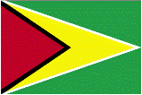
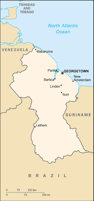
Guyana
|

|
Capital: Georgetown
Population: 782,766
Brief History of Guyana:
The land of Guyana was originally settled by the Arawak and Carib tribes. They named it Guiana, which stands for ?land of many waters?. The first European settlers were the Dutch, who came in the late 1500s. However, the British took over many years later in 1796.
In 1966 Guyana gained independence from Britain and became a republic in 1970. Sinc then however the political history of the country has been somewhat turbulent.
The Geography of Guyana
Total Size: 214,970 square km
Size Comparison: slightly smaller than Idaho
Geographical Coordinates: 5 00 N, 59 00 W
World Region or Continent: South America
General Terrain: mostly rolling highlands; low coastal plain; savanna in south
Geographical Low Point: Atlantic Ocean 0 m
Geographical High Point: Mount Roraima 2,835 m
Climate: tropical; hot, humid, moderated by northeast trade winds; two rainy seasons (May to August, November to January)
Major cities: GEORGETOWN (capital) 132,000 (2009)
The People of Guyana
Type of Government: republic
Languages Spoken: English, Amerindian dialects, Creole, Hindi, Urdu
Independence: 26 May 1966 (from UK)
National Holiday: Republic Day, 23 February (1970)
Nationality: Guyanese (singular and plural)
Religions: Christian 50%, Hindu 35%, Muslim 10%, other 5%
National Symbol:
National Anthem or Song: Dear Land of Guyana, of Rivers and Plains
Economy of Guyana
Major Industries: bauxite, sugar, rice milling, timber, textiles, gold mining
Agricultural Products: sugarcane, rice, wheat, vegetable oils; beef, pork, poultry, dairy products; fish, shrimp
Natural Resources: bauxite, gold, diamonds, hardwood timber, shrimp, fish
Major Exports: sugar, gold, bauxite/alumina, rice, shrimp, molasses, rum, timber
Major Imports: manufactures, machinery, petroleum, food
Currency: Guyanese dollar (GYD)
National GDP: $5,851,000,000
** Source for population (2012 est.) and GDP (2011 est.) is CIA World Factbook.
Back to Geography Home Page
