|
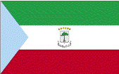
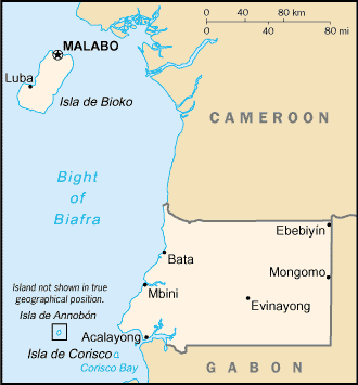
Equatorial Guinea
|

|
Capital: Malabo
Population: 1,355,986
Brief History of Equatorial Guinea:
The area that is now Equatorial Guinea was inhabited for many years by local tribes and the Pygmies. During the European colonization period, Spain took over the area and had control for around 190 years. In 1968 Spain granted the country full independence.
In 1979 President Obiang Nguema gained power over the Equatorial Guinea government in a coup. Since then he has ruled more like a full dictator than a president. The country itself has become rich due to oil reserves found off the coast. However, the majority of the population is still poor and has sub-standard living conditions.
The Geography of Equatorial Guinea
Total Size: 28,051 square km
Size Comparison: slightly smaller than Maryland
Geographical Coordinates: 2 00 N, 10 00 E
World Region or Continent: Africa
General Terrain: coastal plains rise to interior hills; islands are volcanic
Geographical Low Point: Atlantic Ocean 0 m
Geographical High Point: Pico Basile 3,008 m
Climate: tropical; always hot, humid
Major cities: MALABO (capital) 128,000 (2009)
The People of Equatorial Guinea
Type of Government: republic
Languages Spoken: Spanish (official), French (official), pidgin English, Fang, Bubi, Ibo
Independence: 12 October 1968 (from Spain)
National Holiday: Independence Day, 12 October (1968)
Nationality: Equatorial Guinean(s) or Equatoguinean(s)
Religions: nominally Christian and predominantly Roman Catholic, pagan practices
National Symbol: silk cotton tree
National Anthem or Song: Caminemos pisando la senda (Let Us Tread the Path)
Economy of Equatorial Guinea
Major Industries: petroleum, fishing, sawmilling, natural gas
Agricultural Products: coffee, cocoa, rice, yams, cassava (tapioca), bananas, palm oil nuts; livestock; timber
Natural Resources: petroleum, natural gas, timber, gold, bauxite, diamonds, tantalum, sand and gravel, clay
Major Exports: petroleum, methanol, timber, cocoa
Major Imports: petroleum sector equipment, other equipment
Currency: Communaute Financiere Africaine franc (XAF); note - responsible authority is the Bank of the Central
National GDP: $26,100,000,000
** Source for population (2012 est.) and GDP (2011 est.) is CIA World Factbook.
Back to Geography Home Page
